


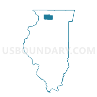
FORRESTON 1 Voting District, Ogle County, Illinois
About
Outline

Summary
| Unique Area Identifier | 573752 |
| Name | FORRESTON 1 Voting District |
| County | Ogle County |
| State | Illinois |
| Area (square miles) | 12.12 |
| Land Area (square miles) | 12.10 |
| Water Area (square miles) | 0.02 |
| % of Land Area | 99.87 |
| % of Water Area | 0.13 |
| Latitude of the Internal Point | 42.13687520 |
| Longtitude of the Internal Point | -89.63878590 |
Maps


Graphs
Select a template below for downloading or customizing gragh for FORRESTON 1 Voting District, Ogle County, Illinois


Neighbors
Neighoring Voting District (by Name) Neighboring Voting District on the Map
- CHERRY GROVE/SHANNON 2 Voting District, Carroll County, IL
- FORRESTON 2 Voting District, Ogle County, IL
- FORRESTON 3 Voting District, Ogle County, IL
- MARYLAND Voting District, Ogle County, IL
Top 10 Neighboring County Subdivision (by Population) Neighboring County Subdivision on the Map
- Forreston township, Ogle County, IL (2,080)
- Cherry Grove-Shannon township, Carroll County, IL (1,485)
- Maryland township, Ogle County, IL (535)
Top 10 Neighboring Place (by Population) Neighboring Place on the Map
Top 10 Neighboring Unified School District (by Population) Neighboring Unified School District on the Map
- Forrestville Valley Community Unit School District 221, IL (5,146)
- Eastland Community Unit School District 308, IL (4,268)